Topographical Survey
Services
Topographical Survey
The topographic survey is one of the key components of the design process for a site, and it's very important to commission one before any detailed design work is carried out. Topographic surveys are also known as land surveys, topographical surveys and terrain surveys.
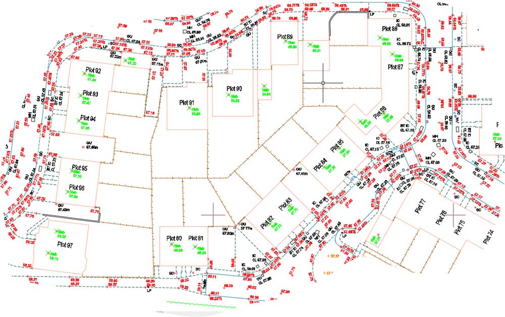
During the initial phase of any project or development, topographical surveys are a necessary component to ensure the success of the project. Constructed from measured elevation points on a particular piece of land, presented as contour lines on a plot. A land survey details the natural and built environment and will impact on the development and progress of project.it is therefore essential that they are carried out with a high level of accuracy and efficiency. With the help of our professional team, we offer these qualifications and a professional, affordable and personal service that caters to our clients' needs.
Surveying is done by an on-site surveyor using survey equipment (Total Station, GPS) that is among the most accurate in the market within <3mm accuracy., As a result, you can feel confident that we are capable of delivering exactly what you have requested. In addition, our office staffs utilize highly technical data transfer and imaging software to produce technical drawing.
No matter what type of project you are undertaking, whether it is a development site for housing or commercial purposes, or a single plot, Geomatics LLC will ensure that you will receive a topographical land survey that is highly accurate, of the highest quality, delivered on time and within budget.
What are the benefits?
The main benefit of topographic surveys is that they help with planning and decision-making. An accurate survey will prevent costly assumptions being made about the size of the site, or about other constraints such as site levels and heights and positions of surrounding buildings.
What can you expect from our topographical surveys data?
Detail is accurately measured and the deliverables issued to meet our clients’ specific requirements. These can range from simple 2D plans to detailed 3D AutoCAD drawings. We ensure the highest quality control by editing our own surveys to ensure all details are recorded and presented accurately.